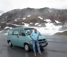
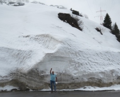
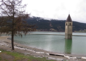
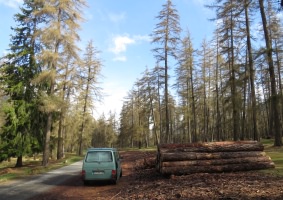
|
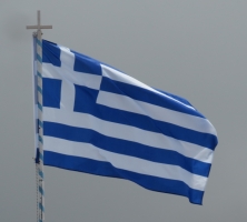 
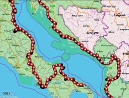
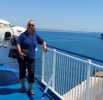
Ten hours later, at 11pm Greek time, which is one hour ahead of Italy, we rolled off the ferry in Igoumenitsa, Greece, in the dark and stopped after a few kilometres on a side road to spend the night.
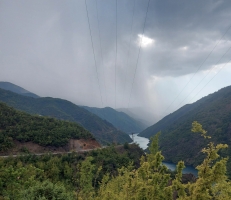
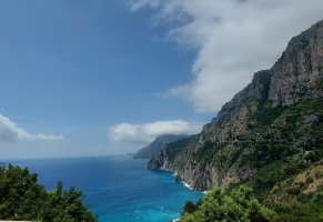
The next day we went south on the coastal road to a beach near Preveza, then to the island of Levkada, where we visited the local Trans-Ocean port captain, Steffi, in Kondarena and later stayed overnight near the floating bridge on the beach at Levkada. The day after we went further south on a narrow coastal road running right along the sea.
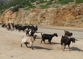
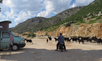
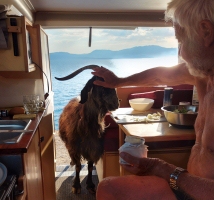
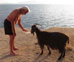
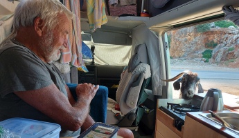
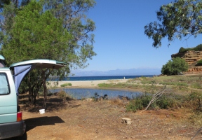
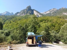
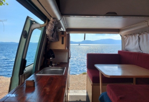 Shortly before Mytikas we found the only spot on the side of the road, where we could stop for the night. A tree gave some shade, the view was terrific and we could go down some steps to the sea and have a swim. We just made ourselves comfortable, when loud tinkling and shouting drew our attention to the street. A large herd of goats was driven along the road by a shepherd on a motorbike. The shepherd sought shelter from the sun in the shade next to the van. We gave him some water and ouzo. After a while all moved on and disappeared. At least that's what we thought. Shortly before Mytikas we found the only spot on the side of the road, where we could stop for the night. A tree gave some shade, the view was terrific and we could go down some steps to the sea and have a swim. We just made ourselves comfortable, when loud tinkling and shouting drew our attention to the street. A large herd of goats was driven along the road by a shepherd on a motorbike. The shepherd sought shelter from the sun in the shade next to the van. We gave him some water and ouzo. After a while all moved on and disappeared. At least that's what we thought.
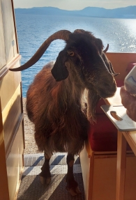 Werner had cut onions and peppers and started to cook, when suddenly a large goat climbed into the back of the van and ate the food off the cutting board. She could hardly be persuaded to go out again. The shepherd came back several times looking for her, but she was always hiding somewhere. When we finished eating, she got some leftovers, after that we thought she was gone for good. But the next morning, just in time for breakfast, she was back. Werner had cut onions and peppers and started to cook, when suddenly a large goat climbed into the back of the van and ate the food off the cutting board. She could hardly be persuaded to go out again. The shepherd came back several times looking for her, but she was always hiding somewhere. When we finished eating, she got some leftovers, after that we thought she was gone for good. But the next morning, just in time for breakfast, she was back.
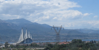
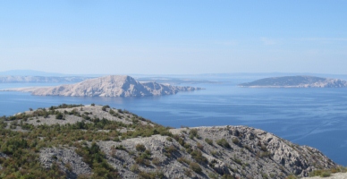
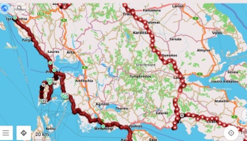
Via Messolonghi we continued to the southeast and crossed for 13.70 Euros over the spectacular Rio Andirro Bridge to the Peloponnese. Past Patras we drove to the west coast of the first finger.
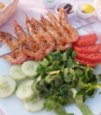
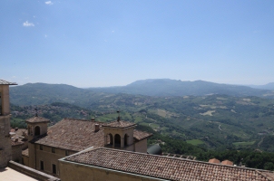
Deep blue sea, delicious Greek food and lots of old forts, ancient sites, wild nature and beautiful campsites. At the beginning we were still a bit scared of the Greek police because officially it is not allowed to camp free. But if you behave inconspicuously, then it is usually tolerated. Only once in a secluded spot, we had a table and chairs outside and the canopy up, when a policeman came. He just politely asked us to put everything inside, then we were allowed to stay.
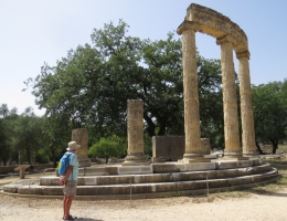
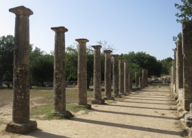
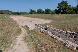
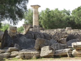
Of course, we couldn't miss ancient Olympia, just a few kilometres east of the coastal road. Werner had been to Greece more than sixty years ago and had visited many of the ancient sites. Back then, some of them weren't even fenced off. Today everywhere they charge high admission fees, but everything is perfectly organized and one or more museums onsite are included. Visiting such tourist attractions, you mostly have to go to an (expensive) campsite nearby. We use this opportunity also to empty the toilet and waste water, fill up with fresh water, take a shower and wash our hair and clothes.
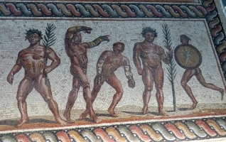
Olympia, the venue of the ancient Olympic Games, impressed us with the Philippeion, lots of pillars of old temples, the original Olympia stadium from the 4th century BC and mosaic floors in the museum. Even today, the Olympic flame is lit there every four years with a concave mirror.
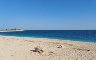
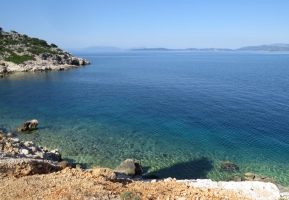
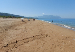
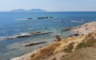
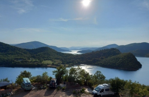
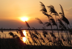
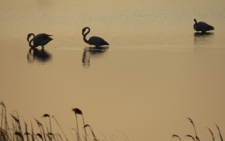
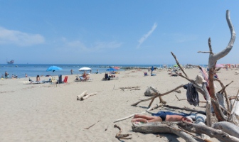
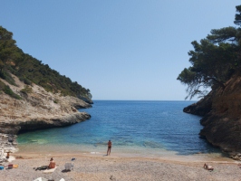
If possible, we always search for a secluded campsite by the sea with some shade, but those are few and far between and where it's beautiful, you're not alone. In Eliah at least, we found the shade and the sea. It wasn't too crowded either, since the access under the shady trees was not feasible for the large campers. On the beach were two public freshwater showers, which you can often find in Greece. There was a good restaurant nearby and we made nice acquaintances with other campers. The kilometre-long sandy beach was used by turtles to lay their eggs, in the morning you could see their "footprints" in the sand. Every day some animal rights activists came, documented the nests and secured them with a small fence. We liked the place so much, that we stayed four nights before heading to Pylos via Kyparissia.
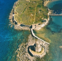
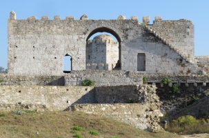
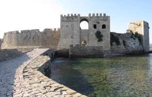
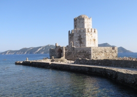
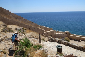
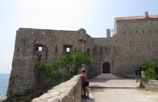
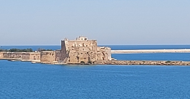
In Pylos we visited the town, the castle and the port. We saw some sailing ships with the Trans-Ocean flag, unfortunately nobody was on board. So we moved on to Methoni, almost at the southern tip of the first finger. The Bay of Methoni is framed by the large fortress, ruins of the old town, surrounded by defiant fortress walls and at the southern end a watchtower, called Burtzi.
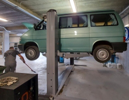
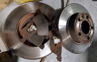
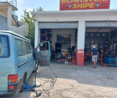
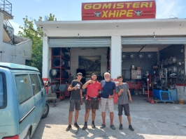
We rounded the first finger and headed north again on its east side, driving on some steep mountain roads. Again and again we heard a slight scraping when braking. An internet search revealed that there is a VW workshop nearby in Kalamata. The next morning on the way to the workshop the noise was gone, but we went there anyway and our suspicions were confirmed. The VW employees were very friendly, all spoke good English and everything made a neat, clean impression, just original VW. We negotiated with a foreman, who explained to us, that the two front disc brakes needed to be completely replaced. We braced ourselves for a high bill, then the estimate was 330 euros. Since I must have looked very incredulous, it was reduced by another 10 percent. After an hour everything was done, the mechanic even oiled our door hinges and checked everything before he swept the workshop spotless again. 300 euros changed hands and we were able to head out into the mountains with new brakes and without any worries.
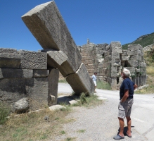
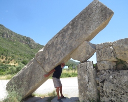
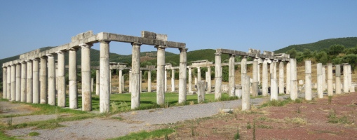
The next destination was ancient Messene with its 9 km long city wall, parts of which are still rising up in the mountains. The remains of the former city, such as the stadium, the mausoleum and the Ekklesiasterion, are widely scattered in the valley.
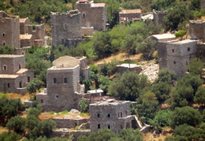
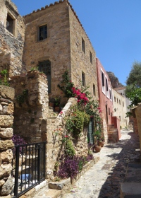
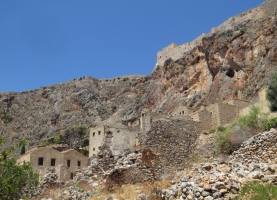
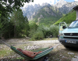
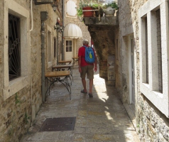
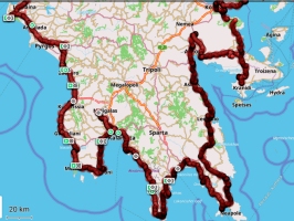
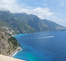
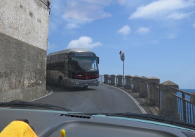
After that we went back towards Kalamata, which we bypassed this time and turned onto the second finger. This area is called Mani. It was very difficult to find a place to stay in the dense development close to Kalamata. In the small harbour of Kardamule we could park for the night. The Mani is still relatively impassable today, narrow roads run close to the coast along the up to 2400 meter high Taygetos Mountains, the main town is Aeropoli.
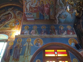
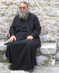
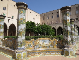
In former times the population there was at odds with each other, hard customs prevailed. For protection, people built high square residential towers from which they shot at each other. Some villages still have these old towers, but most, so it seemed to us, are at least well restored or newly built, being such a tourist attraction. In Aeropoli we were allowed to visit an orthodox church and the pope chatted with us in English.
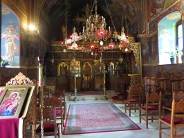  
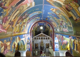
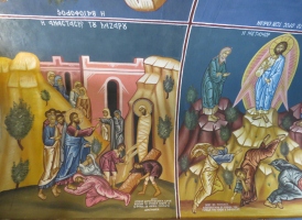
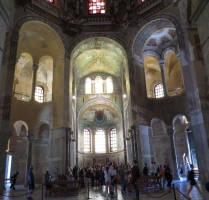
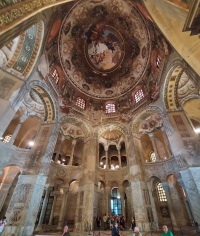
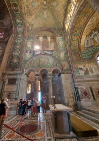
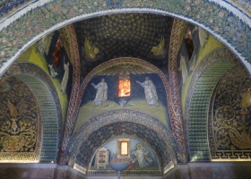
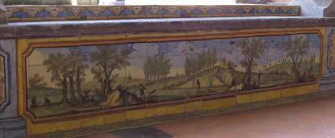
 These two pictures are from another church along the way. These two pictures are from another church along the way.
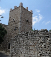 
Old residential tower in Aeropoli and settlement with old and new towers.
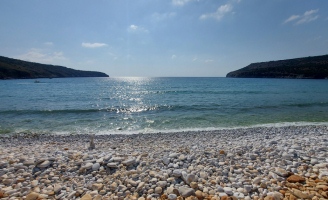
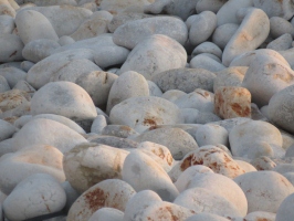
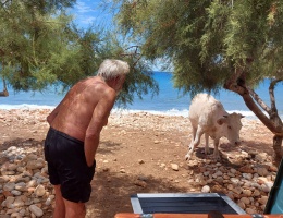
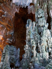
 Shortly past Aeropoli lies the stalactite cave at Pyrgos Dirou, also called Glyfada, which can be explored by taking a boat trip. In the same bay, but accessible via a different road, there is a beach called Dinosaur Egg Bay because of its large, white stones. The beach is very popular with campers, although the police are said to come and chase you away and sometimes demand fines. Nevertheless, the camper vans stand in a long row, small trees donate a little shade. It is difficult to get into the water over the large, smooth stones, especially when there is a lot of swell. In some places there are exposed passages in the water and we have also made sure, that we removed obstructive stones. It was just beautiful there, which probably the cows that kept coming through, thought too. The police occasionally drove their cars past the campers, but nothing happened. After the spectacular sunsets, the jackals howled in the mountains. After a few days we really had to tear ourselves away. We took a half hour underground boat ride in the cave and explored it on foot. Shortly past Aeropoli lies the stalactite cave at Pyrgos Dirou, also called Glyfada, which can be explored by taking a boat trip. In the same bay, but accessible via a different road, there is a beach called Dinosaur Egg Bay because of its large, white stones. The beach is very popular with campers, although the police are said to come and chase you away and sometimes demand fines. Nevertheless, the camper vans stand in a long row, small trees donate a little shade. It is difficult to get into the water over the large, smooth stones, especially when there is a lot of swell. In some places there are exposed passages in the water and we have also made sure, that we removed obstructive stones. It was just beautiful there, which probably the cows that kept coming through, thought too. The police occasionally drove their cars past the campers, but nothing happened. After the spectacular sunsets, the jackals howled in the mountains. After a few days we really had to tear ourselves away. We took a half hour underground boat ride in the cave and explored it on foot.
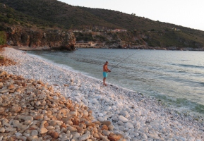  
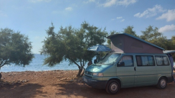
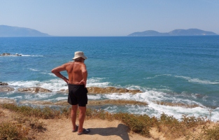
We drove almost to the southern tip of the Mani, which is the southernmost mainland point in Europe after Tarifa in southern Spain, before turning east and then north again. On the east coast, the narrow, winding road runs close to the sea. The journey continued to the next finger, where we had other campsite recommendations from a VW van owner, who we had become friends with in Eliah. First, The "Bozo" Agathoklis. A seaside restaurant that provides a large, partly tree-lined area for free camping, including toilet and waste water disposal. For that you are expected to eat at least once in the restaurant. During the day two cats visited us, in the evening a shy jackal came, which was often chased away by the cats. The beach consisted of coarse gravel.
Quite different was the next place at Biglaphia in the far south-west of the finger. Finest sandy beach and inland a salt pan where you could park. Since the sun was beating down mercilessly from the sky, we retreated to a side path where an old tree was still providing some shade. It was here that the nice policeman came and only warned us (see above).
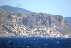
On the east coast of this third finger is a small rocky island connected to the mainland by a causeway. On it perches the town Monemvasia, which cannot be seen directly from land. Built in 583, the fortress was a protection against Slavic attacks in the Byzantine Empire and important for securing the sea route from Constantinople to Venice. The fortress, which is no longer inhabited today, is located on the 184 meter high rock, the houses below are crowded within the city wall. Today, a shuttle bus takes visitors over the long causeway to the entrance in the wall. In the narrow main street, tourists crowd in countless boutique shops, bars and restaurants, but if you walk a little up or down the hill, you can escape the masses. A narrow, steep path leads up to the upper town and the ruins, but that was too strenuous for us in the heat.
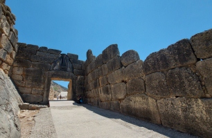
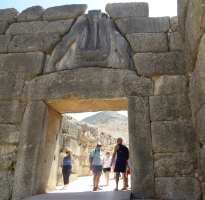
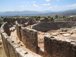
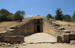
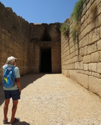
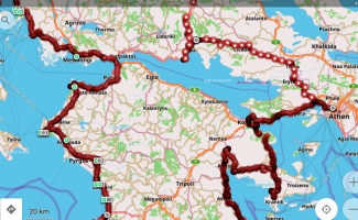
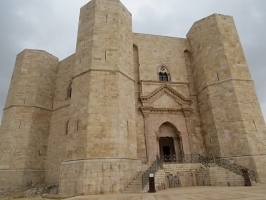
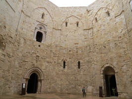
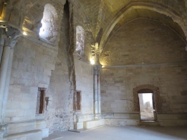
The next major destination was the ancient city of Mycenae, inland north of Argos, perched high on a hill.
The main entrance to the citadel is the lion gate, named after the two lion reliefs above the entrance in the Cyclopean ring wall. Many richly decorated shaft graves were found in the large grave circles with steles. The first Grave circle A was discovered by Heinrich Schliemann, who led excavations there in 1876 and 1885. The extensive citadel complex stretches over the top of the 274m high hill (above sea level).
  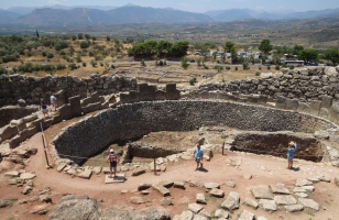 
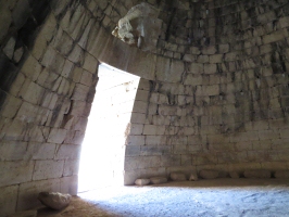
Nearby are beehive tombs, also called tholos tombs, which were built by piling up blocks of stone weighing up to 12 tons.
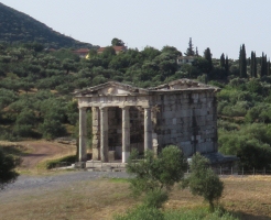
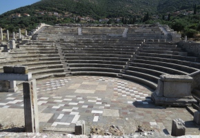
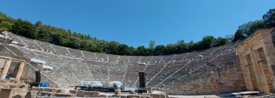
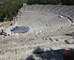
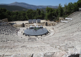
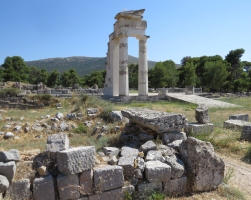
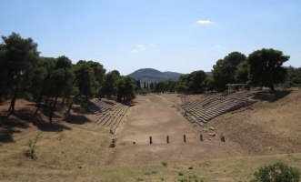
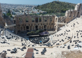
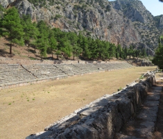
Southeast of Mycenae lies another jewel of Greece, the most important ancient place of worship for the healer gods Asclepius and Apollo, Epidauros. The most significant and impressive building there is the theatre, built around 330 BC. The grandstand offers space for 14,000 spectators and the acoustics are so excellent that you can hear every word from the stage below, even at the top. Performances still take place there today. The ruins of the sanatorium with temples, guest houses, stadium, etc. are close by.
On the last finger of the Peloponnese we only made a detour from Nafplio to Kranidi and north again to Epidaurus.
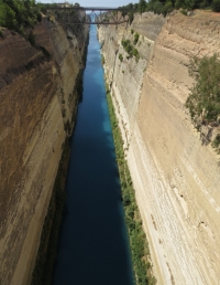
From there it was only a stone's throw to the Corinth Canal, which separates the Peloponnese from the mainland.
37 years ago I passed through the canal on a sailboat during a boat delivery. Now we watched the boats from above.
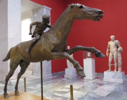
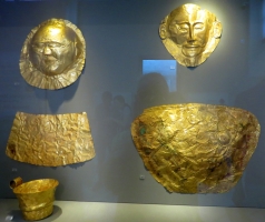
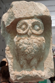
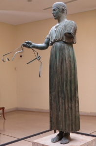
After a restless night in a very full campsite by the sea, we reached Athens on July 24th, and found a shady spot just outside the inner city in the Athens campsite. We bought a five-day ticket for bus and metro. The very next day we went into the city and to the National Archaeological Museum, where we admired, among many other things, the "Rider from Cape Artemision", the gold masks found by H. Schliemann in Mycenae and other valuable gold work, as well as countless other statues, reliefs, vessels, etc.
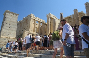
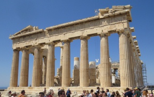
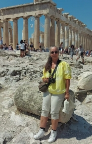
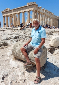
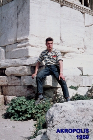
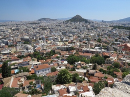
The next day we strolled around the port of Piraeus and on July 27th we went to the Acropolis. The ascent to the castle past the huge theater was easier than expected but the crowds were very large. And then, after 63 and 37 years respectively, Werner and I stood again in front of the ruins of the Parthenon Temple. A fresh wind was blowing and the view from the top over the city with its many ancient sites was terrific.
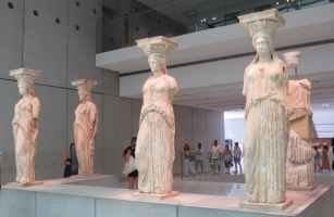
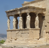
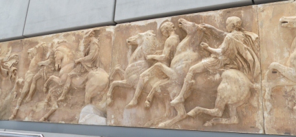
 In the New Acropolis Museum at the foot of the hill we saw many interesting exhibits, including the original caryatids, the female figures of the Erechtheion Temple. And large halls full of figures and reliefs that used to adorn the Parthenon. In the New Acropolis Museum at the foot of the hill we saw many interesting exhibits, including the original caryatids, the female figures of the Erechtheion Temple. And large halls full of figures and reliefs that used to adorn the Parthenon.
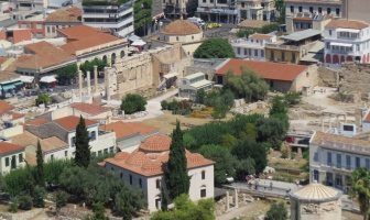
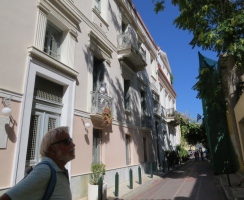
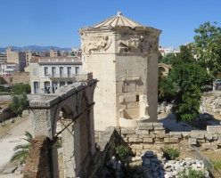
On the last day in Athens we explored the Plaka, the old town, which spreads out at the foot of the Acropolis hill. Narrow streets lead to squares with ancient columns and buildings, here the "Tower of the Winds".
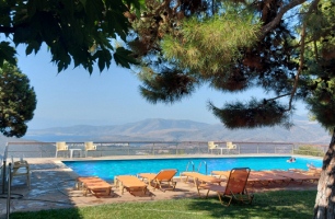
From Athens we headed north-west to Delphi. We found a great space nearby at the campsite Delphi. The view over the valley and the olive plantations was terrific. A large swimming pool and a good restaurant complemented the place. In addition, the owners sell an excellent, multi-award-winning olive oil called "a sea of olive trees".
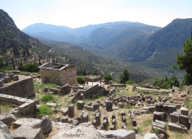
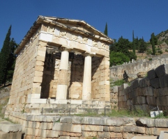
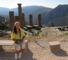
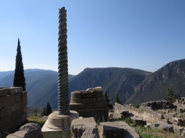
On the morning of July 30th, a shuttle bus brought us right to the entrance of the ancient city of Delphi. The ruins of the city, known for its oracle, rise up a steep mountainside with treasury houses, temples, walls, columns and a stadium at the top.
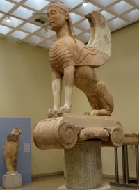
The museum houses many artefacts, including the "Sphinx of NAXOS" and the "Charioteer", which is one of only seven surviving Greek bronze statues. One of the others is the "Horseman of Cape Artemison" in the National Archaeological Museum of Athens (see above).
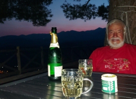
In the evening we celebrated Werner's birthday with a nice meal in the restaurant and a bottle of sparkling wine with a view.
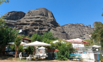
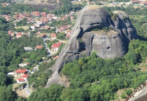
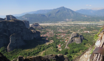
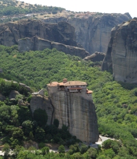
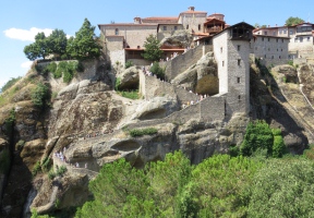
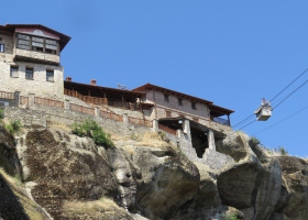
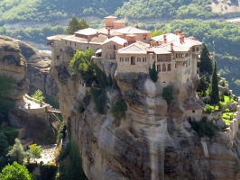
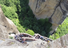
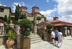
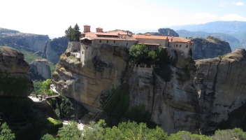
We continued north with a few stops, past the Thermopylae, a narrow plain between the Kallidromos Mountains and the sea, which was repeatedly the scene of battles. Today the coast is much further away due to silting up and the road has room to fork in three directions. We chose the middle route to the northwest, which took us to Kalambaka and Kastraki. Here high sandstone pillars and boulders rise from the ground, on some of their tops "float" 24 monasteries and hermitages. At least that's what the word Meteora means - floating in the air. Six of these monasteries are still inhabited today and can be visited. The campsite "The Cave" is located directly at the foot of the rocks, even from the pool you can already see buildings above. A large shuttle bus collects the visitors in town and links the monasteries according to a schedule. We first drove to the largest monastery, Meteora Megalo. All monasteries can be reached via steep stairways, in the past the monks had to use rope ladders or sit in a net that was winched up by hand. Today you have to climb 143 steps before you stand at the entrance and cash-point. There you are subjected to a strict dress control, long trousers for men and long skirts and shoulder coverings for women. I had my long pareo (wrap) with me, other women were forced to buy wraps or were turned away. The view from the top is simply indescribable. In the far distance you can see the mountains, just in front stretches the plain with the village including the campsite. From there the rocks with or without buildings rise all around. After a tour of the monastery and the steep descent, we walked along the road to the next monastery, Varlaam, where there were even more steps, first down, then zigzagging up the rock. In the afternoon we could take the bus back to the campsite.
Our time in Greece was almost over, via Ioannina we drove to the Albanian border on August 5th.
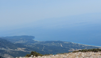
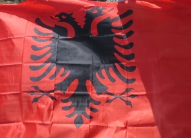 The Greek-Albanian border lies isolated in the mountains, the next larger town is far away. The customs formalities took a while as Albania is not part of the EU. There is also no telephone roaming. You can buy different SIM cards right at the border. I opted for a cheap tourist card for three weeks. Then we looked for an ATM to get Albanian Leke, but there were only exchange offices at the border that exchanged cash for an expensive rate. We had to drive down a narrow, busy mountain road to the sea to get to Sarande. The traffic there was unbelievable, although we were already used to a lot of hazardous driving from the Italians and Greeks. At walking pace we drove through the narrow streets of Sarande, which were even more clogged with cars parking in the second row. We found two ATMs, but thought stopping was impossible. Finally at the third machine Werner was able to stop the van so that I could jump out. He was sweating blood and water in a very tight spot, while I wrestled with a money machine whose touch screen was broken. Luckily there was a fourth machine nearby, which then released some Albanian money. Werner wasn't happy about the long waiting time as an obstacle, but apparently that's quite normal for Albanians. We were very relieved when we finally got out of town safely and started looking for a place to stay on the beach. Big mistake! At the beginning of August everyone was at the beaches. After a long search we found a place near a restaurant by the sea, where we stopped in the midst of many cars, annoyed and tired. The food was so-so, the waiters not very friendly, but at least we could swim in the sea and shower with fresh water. After a night's sleep, the world looked better again. The route north took us inland on the winding SH8 and over the Llogara Pass, with its sharp, narrow, often unsecured turns. More than once I only looked into emptiness from the passenger seat, but the view was fantastic. The top of the pass is 1027 meters above the sea, which can be seen far below. For the night we found a lonely place in the forest just past the pass. In Albania, free standing with the camper is allowed with a few exceptions. The Greek-Albanian border lies isolated in the mountains, the next larger town is far away. The customs formalities took a while as Albania is not part of the EU. There is also no telephone roaming. You can buy different SIM cards right at the border. I opted for a cheap tourist card for three weeks. Then we looked for an ATM to get Albanian Leke, but there were only exchange offices at the border that exchanged cash for an expensive rate. We had to drive down a narrow, busy mountain road to the sea to get to Sarande. The traffic there was unbelievable, although we were already used to a lot of hazardous driving from the Italians and Greeks. At walking pace we drove through the narrow streets of Sarande, which were even more clogged with cars parking in the second row. We found two ATMs, but thought stopping was impossible. Finally at the third machine Werner was able to stop the van so that I could jump out. He was sweating blood and water in a very tight spot, while I wrestled with a money machine whose touch screen was broken. Luckily there was a fourth machine nearby, which then released some Albanian money. Werner wasn't happy about the long waiting time as an obstacle, but apparently that's quite normal for Albanians. We were very relieved when we finally got out of town safely and started looking for a place to stay on the beach. Big mistake! At the beginning of August everyone was at the beaches. After a long search we found a place near a restaurant by the sea, where we stopped in the midst of many cars, annoyed and tired. The food was so-so, the waiters not very friendly, but at least we could swim in the sea and shower with fresh water. After a night's sleep, the world looked better again. The route north took us inland on the winding SH8 and over the Llogara Pass, with its sharp, narrow, often unsecured turns. More than once I only looked into emptiness from the passenger seat, but the view was fantastic. The top of the pass is 1027 meters above the sea, which can be seen far below. For the night we found a lonely place in the forest just past the pass. In Albania, free standing with the camper is allowed with a few exceptions.
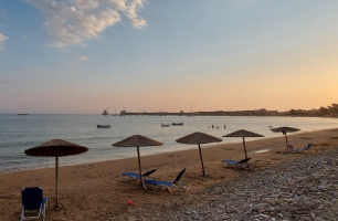
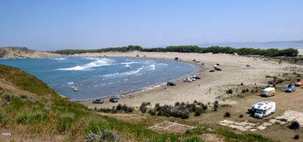
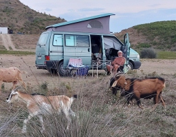
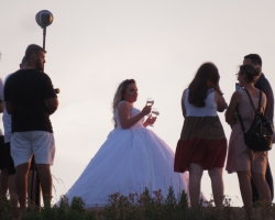
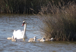
The next day we looked at a few more places by the sea, all of which were either overcrowded or terrible. But the camping apps had listed another place, which could only be reached via a bad, unpaved road. To go to it, we had to drive through the middle of the city of Vlora. Chaotic traffic, roundabouts that everyone just entered, the strongest had the way of right, or the one with the strongest of nerves. Werner tried to make his way through, I helped with waving my hand at the passenger window. It was like in Indonesia, just go with the flow, it will be fine. Even so, the wide palm-lined boulevard along the sea was almost a recreation. The beaches on the left were crowded with sun loungers, parasols, bars and people. The same picture further out of town, cars and persons everywhere. But the closer we got to the small headland, the less traffic there was, especially when the road turned into gravel. Sand dunes to the left of us, to the right a wide marsh landscape with waterfowl. The path got worse, but it wasn't possible to turn around anyway, so we pressed on until we came to a meadow where some campers were already standing. So much for loneliness. Some cars had even ventured onto the sandy beach all around the bay. Just as we arrived, a camper drove off and we quickly got in line. Not a shade tree far and wide, and the wind was blowing strongly into the bay, the light canopy could not be put up. But the place at Zvernec Beach was nice and in the days that followed we got lots of Swabian and Bavarian neighbours with mostly smaller mobile homes. It's not easy to get into conversation with the owners of the big "Tupperware" motorhomes, as some say, but the mostly younger campers with small VW vans and the like form their own community. We made good contact with many and still write to each other today, exceptions prove the rule. Here we liked it better every day. In the evening, first goats and cows came, followed by bridal couples with all their staffage, which photographed and filmed the couples even with drones.
Shortly before leaving we discovered a screw in one of our tires. We were afraid of getting a flat tire while on the narrow gravel road, but everything went well all the way to the repair shop. There we were greeted with a glass of red wine and grapes. The guys had the tire fixed and back on in no time, for only 5 euros. We also received 2 kilos of grapes as a gift.
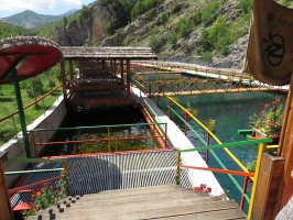
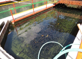
After another failed attempt to get to the sea near Spille, we turned east and went inland. Elbasan and Librazhd were the next stops, then we mastered many kilometres of gravel road north into the mountains. We stopped at a trout farm and wanted to ask if we could buy some trout there. At the entrance we met an Albanian couple who live in Germany. They asked if they could help us and we explained what we wanted. The man translated for us, asked us how many fish we wanted and pulled out his wallet. We protested vehemently, but he could not be dissuaded from paying the 8 euros. They even wanted to invite us for drinks, but we still had a long way to go and could only thank them very much. The Albanians we met were all very cordial and friendly.
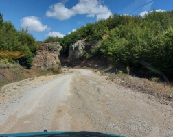   
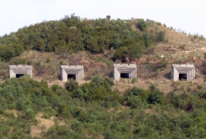
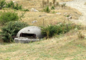
In the late afternoon we had more than 50 km of gravel road behind us, on the way we also saw some bunkers, which are still heaps in Albania. We found a place to stand by the river, a white cat kept us company.
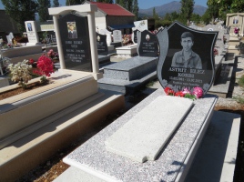
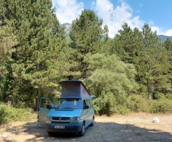
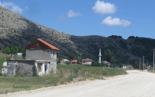
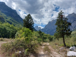
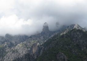
We continued north on narrow roads via Peshkopia to Kukes, which has a beautiful cemetery, then northwest via Bajram Curri into the Valbona valley. There we found a beautiful lonely place in the forest by a little stream. We stayed there for a few days, even with the weather deteriorating and heavy rain falling.
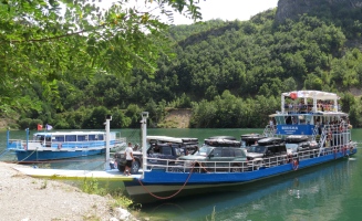
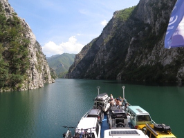
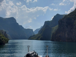
On August 23rd we had booked a place on the ferry that runs from Fierza through the Koman reservoir to the dam. What a fantastic ride! Luckily the good weather lasted until we were back on land.
Just as we were traveling on a very bad and narrow road away from the dam along the Drina river, a heavy downpour made us nearly stop. Luckily we soon found a free place to stay at Ledis Place. Gladly we took our dinner there in the restaurant and enjoyed the great view.
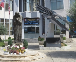
Our last stop in Albania was the city of Shkodra, where we strolled past the Ebu Bekr Mosque through the alleys and bazaars. The Mother Teresa monument stands next to an interesting solar panel system.
After turning our last Albanian leke into gasoline, we crossed the border into Montenegro on August 26th.
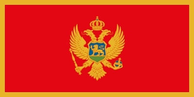
Montenegro is part of the EU and uses the euro as its currency.
First we visited the old town of Budva, which was severely damaged by an earthquake in 1979 and is now painstakingly restored.
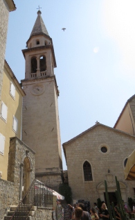
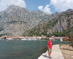
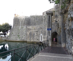
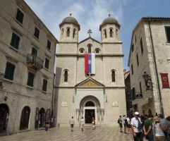
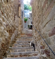
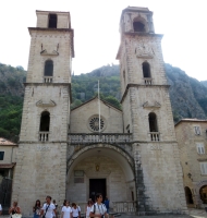
We then followed the road inland, which meanders around a winding bay that reaches deep into the country. At the south-eastern end of the largest bay of the Adriatic Sea, also called Boka, lies Kotor, which was also badly hit by the quake. The city's fortifications extend to the summit of the mountain behind, a massive city wall surrounds the city with its narrow streets, steep stairs and beautiful churches and squares.
We continued around the bay counter-clockwise and from there it was only a short hop to Croatia, where we arrived on August 29th.
Although Croatia belongs to the EU, it still had its own currency at the time, the euro will be introduced at January 1st, 2023.
We could pay in the local currency, the kuna, as well as in euros.
Free overnight stays are not permitted in Croatia, you always have to go to one of the campsites, which are quite expensive and fully packed in summer anyway.
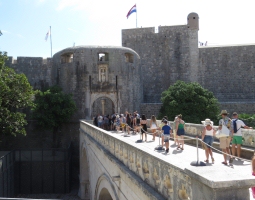
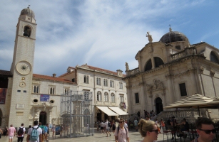
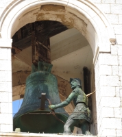
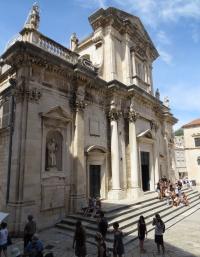
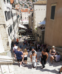
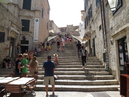
On the second day we took a public bus from Camping Kate to Dubrovnik. The old town is car-free and can only be reached through one of the fortified entrances. The mighty city wall, which encloses the whole city, and many buildings are very well preserved.
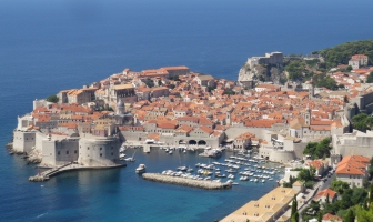 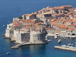  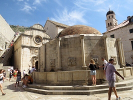
The Market Square, the Rector's Palace with inner courtyard, the stairways, many places seemed familiar to me.
  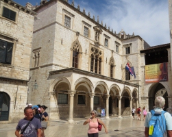 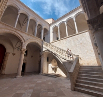
They were all filming locations of the "Game of Thrones" series, as was the Arboretum up the coast.
North of Dubrovnic, a new bridge now shortens the road where previously you had to follow a sea arm reaching far inland. A real relief, however, is the next new bridge, which only opened in June 2022. Before, you had to cross the EU's external border to Bosnia-Herzegovina and back into Croatia for a few kilometres, which could sometimes take hours. Today, coming from the south, turn left before the border onto the Pelješac peninsula, drive past Ston with the salt pans and the mighty fortifications on well-developed roads across the island, and then over the Pelješac bridge back to the Croatian mainland.
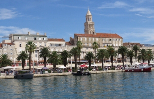
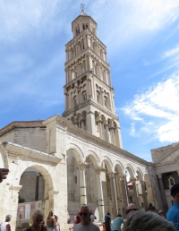
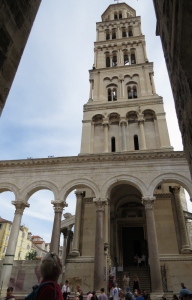
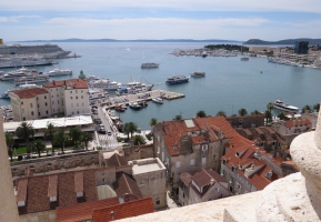
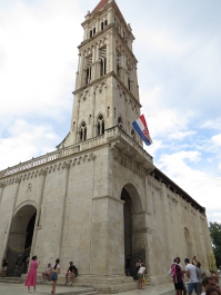
We followed the coastal road past Split and Trogir to the Labadusa campsite on the island of Čiovo. From the jetty at Trogir we took the passenger ferry to Split, the largest city in southern Croatia. Through subterranean vaults, where "Game of Thrones" (GoT) was also filmed, we went up to the peristyle of Diocletian's Palace and the Cathedral of St. Dominus with its campanile, where we ascended all the way to the top. Later we were wandering through the alleys of the old town.
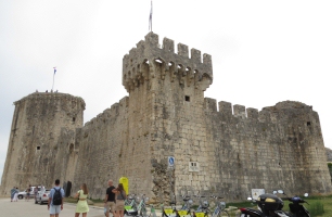
After returning by boat we went for a stroll through the Romanesque old town of Trogir with its cathedral and the fortress of Kamerlengo. Movies were also shot here, GoT, but also Winnetou 3 and others.
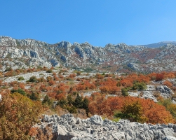
The landscape of Croatia is mostly dry and rocky, but very beautiful. Around 50 years ago, the Karl May films like Winnetou were shot all over the former Yugoslavia, these stories are all set among the Native Americans in North America.
On September 6th we crossed the border into Slovenia, which is an EU country with Euro currency.
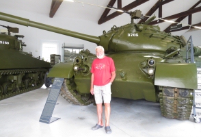
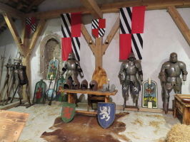
Werner found "his" tank, which he had driven during his basic military service, in a military museum that offered free overnight parking and admission.
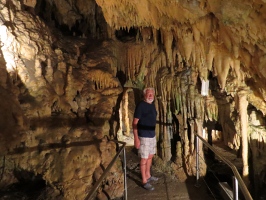
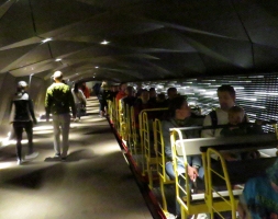
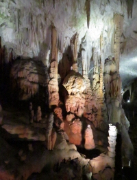
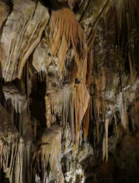
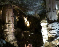
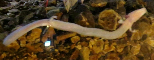
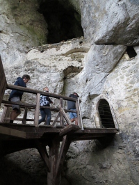
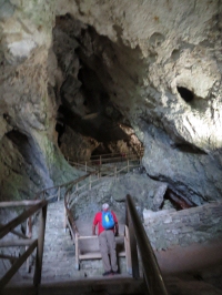
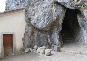
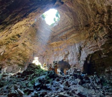
Very close by are the PostojNa Caves, or Postojnska jama. They are the second largest stalactite caves in the world open to tourists and are really worth seeing. Five kilometres of the 24 kilometres of cave system can be visited, the first three and a half kilometres by train. In a darkened aquarium we could see some of their "dragons", endemic blind olms, the second picture is from an information film.
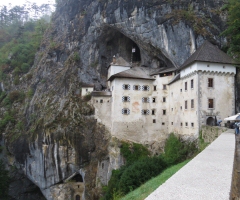
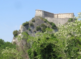
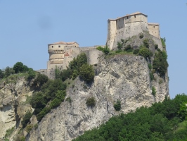
Just a few minutes from the cave lays the Predjama Castle. The cave in an inaccessible rock face was already inhabited in the Palaeolithic Age. In the 12th century a castle was built there, which reaches deep into the lower cave system and has a (secret) exit through the mountain. According to legend, the robber baron knight Erasmus von Luegg, was able to withstand a siege for more than a year. Thanks to supplies via the secret passage, he threw beef and fresh cherries at the besiegers. Only through the betrayal of a servant could the knight be killed, while using the outside lavatory, by stone bullets fired from a cannon.
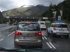
While we visited the cave castle, the rain was pouring down and the weather just didn't want to improve later. So we headed north, drove over the Pramollo Pass to Austria, there we had sunny day near Leifling. After a detour via the Ahrntal into Italy, we went past Bruneck again and over the narrow, cloud-covered Staller Saddle, where only one lane traffic is allowed, back into Austria. Then we passed through the Felberntauern tunnel
to Traunstein in Germany, where we visited friends who gave us a warm welcome and showed us Traunstein. Many thanks!
On September 15th we returned safely to Wurmlingen.
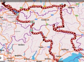
10 countries, almost 8000 kilometres and around 80 campsites in four and a half months. A great trip with many beautiful experiences. The episodes described above are only a fraction of what we experienced, we hope you enjoyed it anyway.
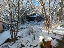
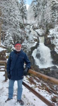
At the beginning of December, the first snow fell, which unfortunately didn't last until Christmas. On the other hand, we are happy when it is "warm" and the heating can be turned down.
Next year we can finally go back to Tonga. In April we will first go to New Zealand and then to our property Analulu on Fofoa, Vava'u for six months.
Unfortunately, we had a bad cold during the weeks of Christmas and New Year. Werner even got pneumonia and had to be admitted to hospital for 5 days. That's why the greetings come a little later this time.
We wish you
|
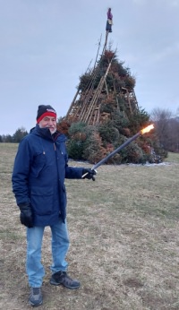
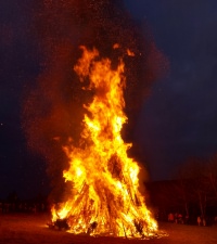
 Immediately afterwards we assisted to drive out the winter with a huge fire.
.jpg)
.jpg)


 A VERY MERRY CHRISTMAS